
-
Place type
Corridors (directly related)
-
Location
St. Louis Park, Minnesota, a suburb of Minneapolis.
-
Site
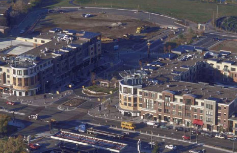
15-acre site, blighted, auto-oriented commercial strip development; part of community plan for a 125-acre downtown development.
-
Program
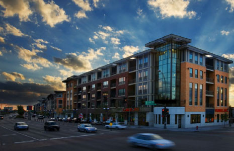
Mixed-use mid-rise containing 338 apartments (some units affordable), 322 condominiums, 88,000 sq. ft. of retail space, 1650 shared structured parking stalls underground and in midblock garages, 265 on-street parking stalls, 1.5-acre town green, and 300-seat amphitheater.
-
Developer
TOLD
Nature
LEED – Neighborhood Development certified community. The Minnesota Department of Trade and Economic Development (now DEED) provided pollution clean-up funding.
Links
Three regular bus lines serve the site along Excelsior Boulevard. There are also two circulator routes connecting employment, community and housing centers. Light rail is planned for the corridor.
Pedestrian and bicycle travel connectivity have also been improved. The project included a redesign of Excelsior Boulevard into a four-lane landscaped avenue with parallel parking. Most retail faces the street. The city also made upgrades to the adjacent park, improving connections to the neighboring recreation center and regional bike trails.
Communities
The site contains a mix of housing, recreational and retail uses. It is within a 1-mile radius of over 10,000 jobs (including a medical center) and over 6,000 other housing units. It is also within a 1-mile radius of extensive retail, entertainment and services. Although the redevelopment site offers a pedestrian-friendly environment, much of the nearby development is currently auto-oriented.
Tools and Actions
The Excelsior and Grand redevelopment project emerged from a city-wide visioning effort that began in 1994. Obtaining funding for the planning and development process was critical to the project’s implementation. The project used a total of $30 million in public financing. This included both state funding and Livable Communities Act, provided through the regional government, which made funding available for infrastructure projects that supported transit and walking. This funding was used for predevelopment planning (a community design charette and market and transit studies) and infrastructure improvements such as structured parking and pedestrian and transit improvements. The city also used a tax increment financing program to fund some improvements. The remaining funding for the project–$98.2 million–was from private sources.
The city purchased 37 properties to make the project work. It did not employ eminent domain (which at the time was legal for private development in the state), although some believe the availability of eminent domain enticed property owners to sell to the city voluntarily.
This was a complex mixed-used project and the first developer dropped out after a year and a half of working on the project. A new developer, TOLD, was selected in July 2000 and opened the project in 2003. Project flexibility was essential to its success. It evolved over time with several design changes to meet the needs of the new developer and changing market conditions.
For example, the town green design changed to be more supportive of the ground floor retail tenants. The market rather than the city determined the residential unit size and mix, commercial tenant selection, and some characteristics of the affordable housing element.